A flight plan comes before the first photograph. Site access, launch point, building height, nearby people and the roof sections to be covered are written down, and the pilot confirms the airspace and the property owner's consent. Only then does the aircraft go up. The preparation takes less time than the flight, and it is what makes the imagery usable.
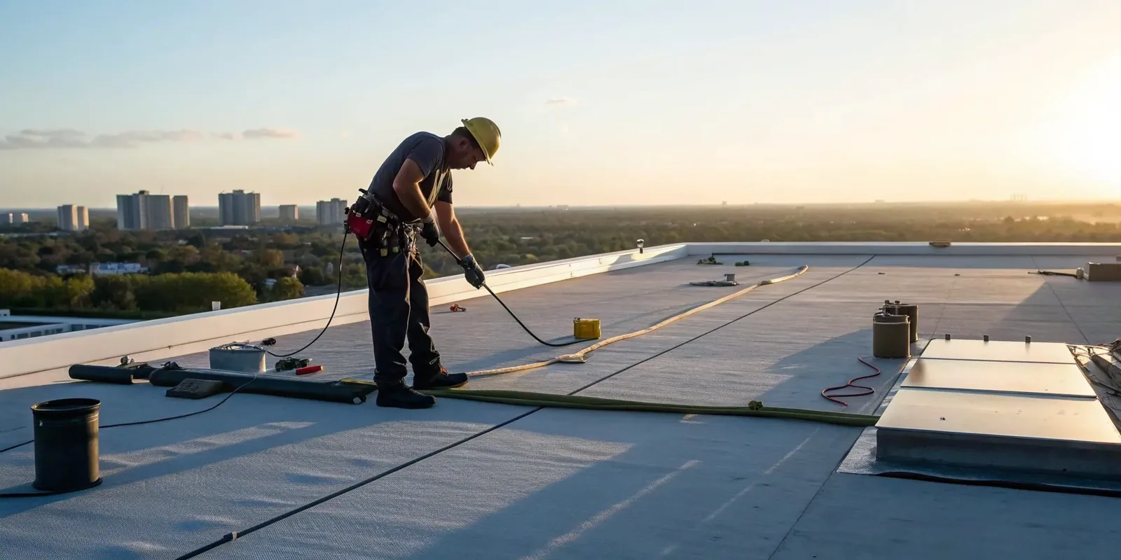
For a facility director in Lowell, MA, the value of a drone is speed and coverage on roofs that are slow or unsafe to walk. A long flat roof can be imaged edge to edge in a fraction of the time it takes on foot, and a steep or fragile surface can be viewed without anyone stepping on it. The images do not replace a hands-on visit. They show where to look, and the roof team confirms each flagged item by hand before it becomes a line in the scope.
What the aircraft captures
A visual pass produces overlapping high-resolution photographs of the full roof surface, plus oblique views of parapets, edges, penetrations and equipment. Stitched together, they form an overhead map of the roof that can be zoomed to individual fasteners, seams and patches. Close passes at low altitude capture details such as split flashing, open laps, damaged coping, blocked drains and displaced ballast.
Imagery also records the surroundings. Standing water, debris from neighboring trees, vegetation at the base of walls, and rooftop equipment in poor shape are visible from above. For a roof with heavy HVAC equipment, the overhead view shows pipe runs and curb conditions that are hard to see at ground level.
Each image carries a location and a time, so a defect found in one flight can be compared with the same spot in the next. That comparison is how slow deterioration, such as a seam that opens a little each winter, becomes visible.
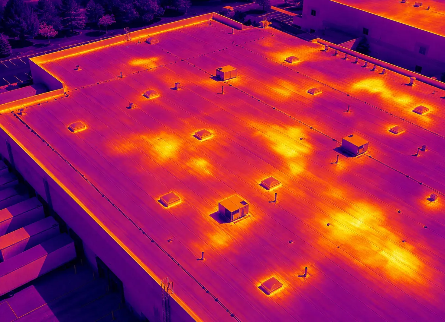
Thermal imaging can be added to a flight at the right time of day. A camera that reads surface temperature shows cooler or warmer patches after sunset, and those patches mark places where insulation may hold water. They are only markers. Each one is confirmed with a core cut or a moisture meter before anyone writes it into a repair scope, so the thermal pass narrows the search without settling it.
Where the drone stops and the hand inspection starts
The camera sees the surface. It does not see what is under it, and it does not test seams or probe flashing. Wet insulation under an intact membrane is invisible in a visible-light image, so moisture questions move to an infrared and core-cut survey. Soft spots in the deck, loose fasteners under the membrane and a membrane that has lost flexibility are found by walking.
The standard sequence is flight first, hands-on second. The images are reviewed, and each flagged location is marked on the roof plan. A technician then visits those locations, probes seams, tests flashing, takes photographs at close range and records the finding. The result merges into a standard commercial roof inspection report, so the facility director sees one document and not two.
On roofs where the structure is questionable, the walk is limited to the safe areas, and the drone imagery becomes the primary record for the rest.
Large industrial and mill roofs
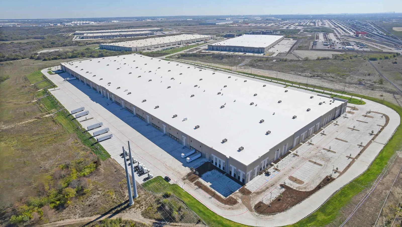
Drone work earns its keep on big and awkward roofs. The Ayer's City Industrial Park plan describes a roughly 108-acre area around Tanner Street, mostly zoned for heavy industry, and a heavy-industry site can put several buildings, roof levels and equipment layouts in one area. Imaging all of them in one session produces a consistent record that can be ranked by condition.
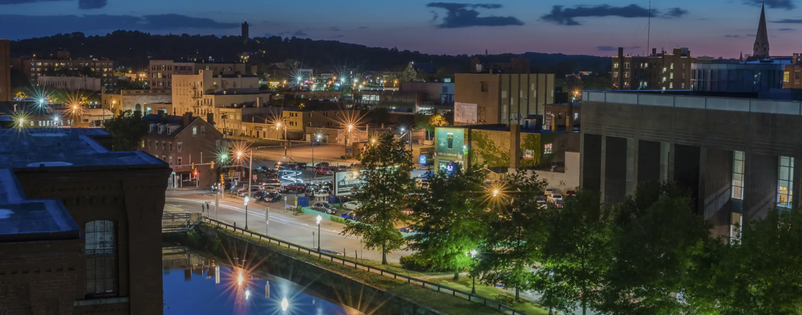
Mill buildings downtown present a different problem. Downtown, the historic district's mill yards and canal system sit beside a commercial district, and the city points to a deep legacy mill-building stock. A multi-level mill roof with parapets and rooftop additions takes time to cover on foot, and the aircraft shortens that. In nearby Lawrence, the city lists industrial-park space and historic mill buildings in its commercial property base, so the same flight approach applies.
For a distribution center roof, the imagery reveals drainage patterns, skylight and smoke-vent condition and equipment placement across a wide surface.
After storms and before a claim
After a nor'easter or ice storm, a drone survey can establish quickly which buildings in a portfolio need a crew first. Lowell's hazard mitigation record lists hurricanes, nor'easters, snowstorms and ice storms among its major natural hazards, and each one leaves a different pattern on a roof. Wind lifts edges and moves ballast. Snow loads press insulation and open seams. Ice blocks drains and leaves ponding.
Images taken soon after an event, and compared with baseline images from earlier flights, show what changed. That helps with storm damage repair because the repair scope can be limited to damage that appears in the later images and not in the earlier ones. It also gives an insurer a dated visual record.
Snow cover limits what a camera can show, so flights are scheduled after the roof has cleared where the question is surface damage. Winter flights still help with edges, drains and visible equipment damage.
Safety, privacy and permissions
Commercial drone flights follow federal rules for pilot qualification, aircraft registration and airspace. The pilot checks the airspace at the property before launch and keeps the aircraft within visual line of sight. Nearby people are kept clear of the flight area, and the pilot stops if conditions change.
Privacy matters on occupied sites. Flights are scoped to the roof, and images of neighboring properties are cropped or excluded from the file the facility director receives. Tenants are told when the flight will occur, since a drone overhead raises questions the building team should be able to answer.
Wind and precipitation limit when flying is possible. A calm, dry day gives the sharpest images, and a gusty day is postponed. The date is set around the building's access and the weather, and the facility director is told the evening before if a hold is called. Several sites can be flown in one visit to keep scheduling simple.
Commercial Roofing Questions
Can a drone replace a walking inspection on a large warehouse roof?
It replaces most of the walking, not all of it. The aircraft covers the surface and flags locations, and a technician confirms each flagged location by hand. Seams, flashing and drains still need to be touched and tested.
What does the facility director receive after the flight?
An annotated roof map, close-up images of every flagged defect, a short list of confirmed findings with locations and recommended actions, and the raw image set. Priority and cost ranges follow once the hands-on confirmation is complete.
Does a drone find leaks?
It finds the conditions that cause them: open seams, failed flashing, blocked drains and ponding. It does not see water inside the assembly. A leak that has no visible cause moves to moisture mapping and a water test.
How do you handle flights over a hospital or a school campus?
Those properties get a plan written with the facility office: the time window, the launch point, the restricted zones and the people who need notice. A property like Lowell General Hospital, named among the city's major employers, gets the plan before the date.
Is drone imagery useful for an insurance claim in Massachusetts?
Dated images from before and after an event show what changed on the roof, which supports the scope. The images are one part of the record, with the hands-on findings and a written statement of damage.